Since 2021, INTERRASCAN LLC has been developing and implementing unique and innovative geophysical technologies based on the Russian science breakthroughs. The Company's experts have over a decade of successful experience in developing high-resolution geoelectric exploration techniques and tailor-made software.
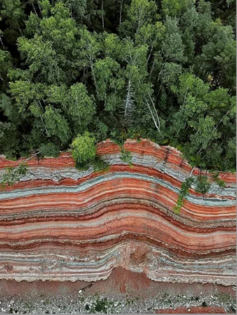
Deep High-Resolution Pulse Geoelectric Exploration (DHRPGE) – is a new stage in developing non-destructive geophysical express methods allowing for high-detailed geological strata exploration at up to 400 m depths, as well as for high-resolution surveys at depths of up to 50 m, crucial for solving engineering geology tasks.
DHRPGE technology has a long-term success story in geological exploration. Its application ensures significant increase in the speed and efficiency of engineering and geological surveys and lets prevent and/or minimize accidents and disasters caused by hazardous geological phenomena and man-made impacts on the subsurface.
The DHRPGE technique is highly efficient in surveys of complex, flooded and saline soils and permafrost exploration, it works from any surface (fresh water, ice, snow, swamp, etc.) in any season.


Technology
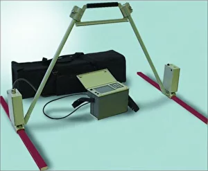
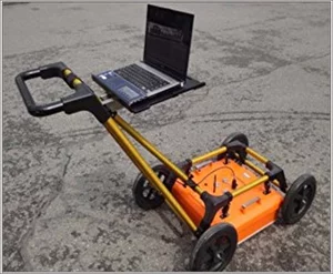
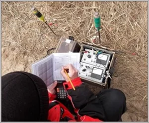
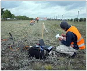
DHRPGE is a contactless pulsed geoelectrical exploration technology based on a modification of GPR that uses an ultra-wideband electromagnetic signal in the range of 1-1000 MHz for sounding soils, and antennas in the form of resistive-loaded dipoles. Depending on the tasks and the required depth, antennas of various lengths are used.
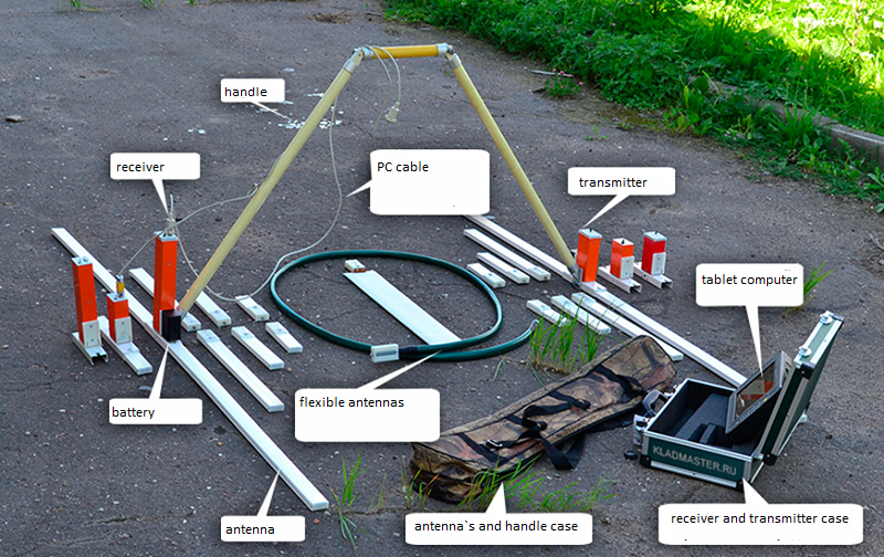
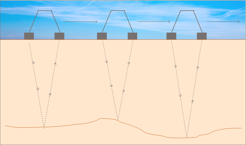
The technology is based on registration of reflected electromagnetic waves from subsurface with different geoelectric parameters. These parameters are closely correlated with the physical properties of geological elements: density, porosity, moisture content, and others. The main information about geological structures is the amplitude of the pulse reflected from the interface, its shape, polarity and the time interval between the generation of the pulse by the transmitter and the registration by the receiver of signals reflected from the sections of geological media. During exploration, the GPR moves along the profile between physical measurement points with a specified step or with continuous shooting along the horizon. Modern GNSS equipment is used to bring the profiles to the terrain.
The signal source generator has the ability to adjust the power for surveys at different depths and generates a nanosecond pulse (unipolar pulse without high-frequency filling) with a steep leading edge. The steep leading edge of the pulse and its large amplitude determine the high resolution of the technology, the large depth of sounding, and the ability to work in low-resistance environments – like wet soils, clays and loams.
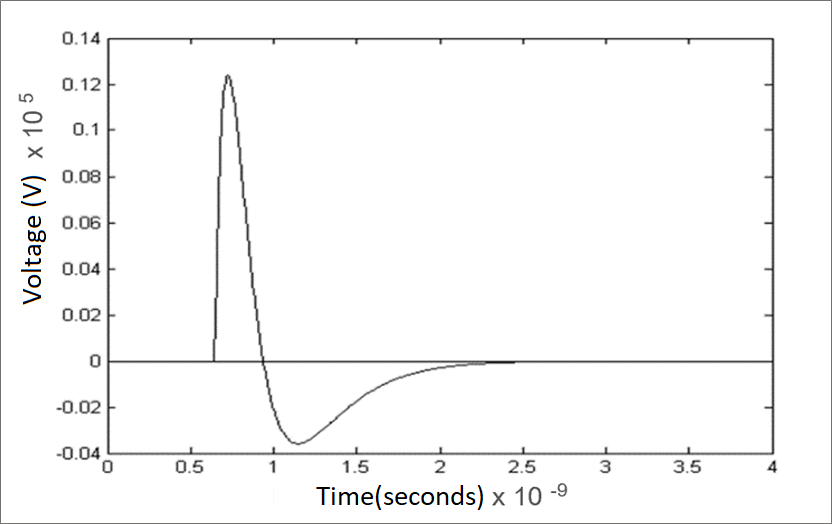
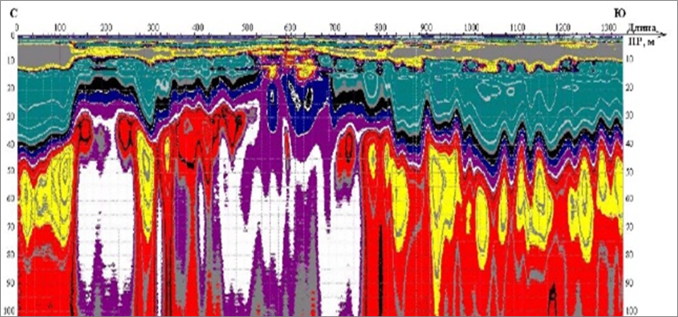
The result of the exploration is a geoelectric section (radargram), translated into a depth scale. The translation is carried out based on the results of field calibration and reference to existing geological wells, archival data of engineering and geological surveys. The results of impulse electrical exploration can be compared with the results of seismic exploration and classical geoelectrical exploration.
DHRPGE Advantages
VS
Sounding depth: 0.1 m - 400 m
Application scope: structures with high electrical resistance (dry sands, fresh ice) as well as environments with low resistance (moistened soils, thawed frozen rocks, saline soils, etc.)
Simplicity and transparency of research
Formation of a "digital footprint" of an object
Equipment Availability
Opportunity to train customer employees
Existing Alternatives Disadvantages and Limitations
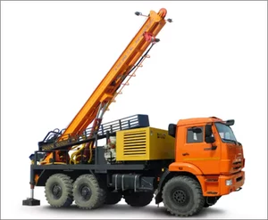
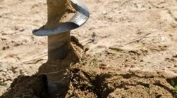
Direct methods (boreholes, pitches)
- The high cost of 1 borehole - over 300 million rubles (for crude oil)
- Long mobilization of heavy equipment
- Lack of data on areas between drill holes
- Long research duration
- Methods that violate the geological space
Classic geoelectric exploration
- High labor intensity and long work duration
- Lack of data on areas between drill holes
- Complicated mobilization
- Large inaccuracy (up to 50%) due to the a priori structure model
- Contact methods
- Limited seasons in-situ work
Shallow-deep seismic exploration
- Long research periods
- Complicated mobilization
- High labor intensity and costs
- Lack of information about the upper boundaries of the section in waterlogged soils
- Does not separate the boundaries of structures: thawed/frozen; hydrocarbons/water, etc.
- Contact method

Classic GPR
- Low survey depth
- Low information value
- Fast signal decay in flooded loams
- Low signal power
Application Areas

DHRPGE IN GEOLOGICAL EXPLORATION
...................
Identification of prospecting indicators of mineral deposits and exclusion of non-perspective area
...................
Optimization of exploration and verification boreholes places
Localization and delineation of deposits, including deep-seated:
- ore gold
- sulfide-magnetite ores
- manganese and gold mineralization in weathering crusts
- uranium-bearing metasomatites
- copper-zinc-sulfide ore bodies
- pyrite-polymetallic ore bodies
- rare earths and vanadium in weathering crusts
- contouring of kimberlite pipes
- detection of crystal-bearing quartz veins
- exploration of coal deposits
............
Identification of geomorphological structures favorable for the formation of gold placers, incl. buried paleostructures
............
Localization of aquifers, water-conducting technogenic cracks and cavities, natural fissuring of rocks that pose a danger of mine flooding

DHRPGE IN GEOLOGICAL ENGINEERING
...................
Detection of ground interfaces and anomalies
...................
Location verification of underground communications
...................
Control of latent construction works
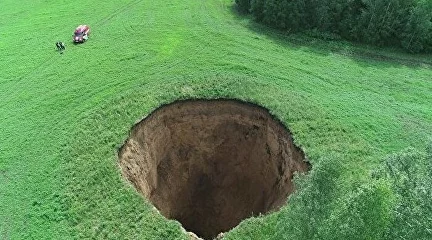
Localization of underground cavities, karsts, cracks, decompaction zones and other anomalies of the geological strata
............
Survey and monitoring of:
- state of soil bases under foundations of buildings and structures
- condition of the roadway, railway embankments, runways
- permafrost degradation, position of frozen rocks roofs
- groundwater levels, aquifers
- zones of latent leaks of aggressive products and pollution zones
- bases and anomalies of municipal solid and industrial waste landfills
- soil dams and tailings
............
Engineering communications mapping
............
Determination of the actual depths of foundations, piles, drainage systems, bridge supports, pipelines (including underwater occurrence)
Cases: Geological Exploration


Cases: Engineering Geology


Roadmap
- Customer task
- Technical and commercial offer
- Preliminary estimate
- Price justification
Stage 1
- Non-disclosure agreement
- Exchange of historical geological data (if available)
- Contract + Terms of Reference + Estimate
Stage 2
- In-situ work
- Office data processing
- Scientific and technical report
- Presentation of results
Stage 3
Value Proposition
Reliable and detailed
Non-destructive technology
Express, high quality, inexpensive
Making of a soil ground digital footprint
Lower risks

Extra data on dangerous anomalies
Ratio of exploration costs to potential damage
200 times
Cost reduction
Fewer direct boreholes
Optimization of boreholesnumber and position
5 times
Information value increase
Decrease in anomalies omission probability
Detailed exploration on a continuous profile
> 20 times
Reviews and Recommendations

21 апреля 2023 г.
Nornikel
The DHRPGE technology can be recommended by us for solving numerous practical problems in geological exploration, engineering geology, and will undoubtedly be useful in environmental monitoring and in other areas.

24 января 2023 г.
Industry Energy Forum
A letter of thanks for constructive participation in the TNF 2022 Industry & and Energy Forum.

31 августа 2022 г.
R&D Center of Construction
R&D Center of Construction denotes its interest in developing GPR technologies application in construction pre-project surveys as an indirect geophysical method in geological engineering.

30 августа 2022 г.
ZOLOTOI AKTIV
We are interested in expanding and developing the functionality of the deep GPR software, so that within further cooperation it would be possible to obtain more accurate and illustrative information on subsurface structures

28 мая 2022 г.
RusHydro
The Minutes: “The results of the GPR-method survey on the hydrotechnical systems of the Chiryurtskaya and Gotsatlinskaya power plants... shall be recognized successful ...”

12 апреля 2022 г.
National Technology Initiative
‘ANO NTI Platform assesses the Company's approach to the development and operation of deep GPRs as scientific and profoundly professional.’

28 февраля 2022 г.
Moscow Institute of Physics and Technology (MIPT)
‘The INTERRASCAN team has a sound scientific and professional approach to the studies of subsurface anomalies. We highly recommend cooperation with this company to all interested organizations.’

24 декабря 2021 г.
Gazpromneft
"Your project is bold, the idea is innovative the team is really strong and goal-oriented.”
Clients
NORNICKEL
Subsurface anomaly detection under utility/building foundations on permafrost
Gazpromneft
Localization of underground leaks of oil products
RusHydro
Dam body survey to localize damage
NLMK Group Novolipetsk Metallurgical Plant
Detection of empty ore zones in iron ore quarries

Zolotoi Aktiv Holding Company
Inspection of gold deposits in order to localize the position of the ore body
Department of Construction and Housing Policy, Yamalo-Nenets Autonomous Area
Front-end engineering & design, monitoring of grounds under building/utility foundations
Severstal
Survey of mine workings, search for lost boreholes

UGMK
Inspection of gold deposits in order to localize the position of the ore body
Scientific partners


Useful Links

MINING JOURNAL, published since 1825, published an article written by Interrascan LLC together with Timer LLC
IS IT POSSIBLE TO REACH A DEPTH OF 1 KM USING GPR? (In Czech)If you put this question to a geophysicist or someone who regularly works with GPR, you will usually be told that this is impossible. And they are right – if they rely on practical experience and generally accepted calculations. Let's look at this question from a slightly different perspective.
PHYSICAL FOUNDATIONS OF THE GEORADAR METHOD, EQUIPMENT, DATA PROCESSING TECHNIQUE (In Russian)The scientific article describes the operation principle subsurface radar sounding equipment based on the emission of ultra-wideband (nanosecond) pulses and reception of signals with different electrophysical properties reflected from the interface between the layers of the probed geological structure
GEORADAR AS A WAY TO SEE THE 'UNDERGROUND WORLD' (In Russian)The popular-scientific article (the HABR platform) describes the GPR history, and dwells on the main existing devices and principles of their operation.
SUBSURFACE RADIO LOCATION ISSUES (In Russian)The scientific monograph edited by A. Grinev describes various methods of radio image reconstruction, processing of signals and images of the subsurface and objects probed by ultra-wideband (UWB) signals. The said methods are used to monitor and diagnose underground utilities, soils for construction sites, road surfaces and local inhomogeneities in the soil, to detect mines, leaks from underground fuel storages, to control groundwater levels, as well as during geophysical and archaeological exploration. The specifics of propagation of UWB signals in geological structures with pronounced attenuation and dispersion are considered; various approaches to solving inverse problems of subsurface sounding are described.
Our Team

DUYSINALIEV
Nurbulat Amangeldievich
CEO
MBA "International oil and gas business", extensive experience in the oil and gas sector, NTI expert, member of the working group NTI "ECONET"
BYCHKOV
Georgy Vasilievich
Deputy CEO
Expert in intellectual property, international communications. Extensive experience in formulating and implementing start-up projects in Russia and abroad

GORKIN
Dmitriy Sergeevich
CTO
Lead engineer IZMIRAN, experience in geophysical work in Russia and abroad since 2007, «VNIISMI», «Timer», «Geojet», qualification of a forensic construction expert
ANTIPOV
Vadim Valerievich
Lead geotechnical engineer, web developer
PhD, Data Scientist, Python, JavaScript web developer, experience in BIM modeling, numerical modeling, Data Engineering

AVERIN
Alexander Anatolievich
Radioengineer
Specialist in the field of industrial safety, scientific organization of labor during field work on geophysical surveys

GULYAEV
Oleg Viktorovich
Geological engineer
Python web developer, extensive experience in the oil and gas industry, experience in geological numerical modelling based on GIS data, geophysical data
Contacts
Visiting (office) address: 127566, Moscow, Altufevskoe highway 44, 2nd floor, Room III, part of room No. 13
Postal address: INTERRASCAN LLC P.O. Box 104 Alteza Business Center 44 Altufyevskoe highway 127566 Moscow Russian Federation
E-mail: its@interrascan.ru
CEO of INTERRASCAN LLC:
Nurbulat Duisinaliev
E-mail: nurbulat.duisinaliev@interrascan.ru
Cell: +7 (985) 120 9458